memo: How to make watershed map
����E��͓��̃f�W�^���}�b�v�������@�̃���
1. DEM���_�E�����[�h����B
���y�n���@�̊�Ւn�}���_�E�����[�h�T�[�r�X�F
http://fgd.gsi.go.jp/download/
����A�K�v�Ȃ������DEM���_�E�����[�h����iJPGIS(GML)�`���̓z�������j�B
�Ƃ肠�����A���ׂẴf�[�^���_�E�����[�h���Ă݂��B�i���\��ρj
�܂��AFG-GML-*-DEM10B.zip���𓀓W�J�iFG-GML-*-*-dem10b-*.xml���ł���j
---
#!/bin/sh
for zipfile in FG-GML-*-DEM10B.zip
do
  unzip ${zipfile}
done
---
���ɁAXML��TIF�ɕϊ�
---
for xmlfile in FG-GML-*.xml
do
  gdal_translate -of GTiff ${xmlfile}.bin ${xmlfile}.tif
done
---
3. �K���ȗ̈�Ń}�[�W����
�I���W�i���̒n�}�̋敪���Ƃ�����ƍׂ������Ă킯�킩��Ȃ��̂ŁA
�ЂƂ�zip�t�@�C�����Ń}�[�W���Ă��B
---
for x in 35 36 37 38 39 40 41 42 43 44 45 46 47 48 49 50 51 52 53 54 55 56 57 58 59 60 61 62 63 64 65 66 67 68 69 70
do
for y in 20 21 22 23 24 25 26 27 28 29 30 31 32 33 34 35 36 37 38 39 40 41 42 43 44 45 46 47 48 49 50 51 52 53 54 55
do
gdal_merge.py -o ${x}${y}.tif -ps 0.00011111111111 0.00011111111111 -init -9999 FG-GML-${x}${y}-??-dem10b-????????.xml.tif
done
done
----
�Ƃ��ƁA����Ȋ����̃^�C���ɂȂ遨
���{�S�́i�ꕔ�n��������j
4. �ړI�̗�����ӂ�DEM�����o��
�Ƃ肠�����AGRASS��tif��ǂݍ���ŕ\�������Ă����������B
----
r.in.gdal --o input=${x}${y}.tif output=${x}${y}
r.null map=${x}${y} setnull=-9999
r.colors map=${x}${y} rules=srtm
g.region rast=${x}${y}
d.rast ${x}${y}
----
���̌��ʂ����
���{�S�́i�ꕔ�n��������j�Ƃ�����ł��B
����œ���������āA�K�v�ȕ�����K�p�Ƀ}�[�W����
�i�߂������ƂɗR�ǐ여�悊�͂S���ɂ܂������Ă�j
----
gdal_merge.py -o yura.tif -ps 0.00011111111111 0.00011111111111 -init -9999 5334.tif 5335.tif 5234.tif 5235.tif
----
�o����yura.tif��r.in.gdal���āAd.zoom�ŕK�v���������Y�[���A�b�v���āA
����ɁA���̕��������̃t�@�C�������B
----
r.in.gdal --o input=yura.tif output=tmp
r.null map=tmp setnull=-9999
r.colors map=tmp rules=srtm
g.region rast=tmp
d.rast tmp
d.zoom
�i�K���ɃY�[���A�b�v�j
r.out.ascii input=tmp output=tmp.dat
r.in.ascii input=tmp.dat output=yura
g.remove tmp
----
�Ƃ��������ŕ\��������������B
�ir.out����r.in���邠����́A�`���b�g�E���C���C�����ǁA���̕��@���悭�������B
�����ƁA�X�}�[�g�ȕ��@������ɈႢ�Ȃ����j
5. ���悢�旬��E�Ɖ͓��̒��o
GRASS�̃R�}���h�́Ar.watershed ���g���̂��ǂ������B���Ăǂ��g���H
�E�E�E���i20110408)
�ȉ��A������Ɨ��K�i20110408)
d.rast ashu
r.watershed elevation=ashu stream=ashu_stream threshold=10000
r.thin input=ashu_stream output=ashu_stream_thin
r.to.vect input=ashu_stream_thin output=ashu_stream_vect feature=line
d.vect ashu_stream_vect
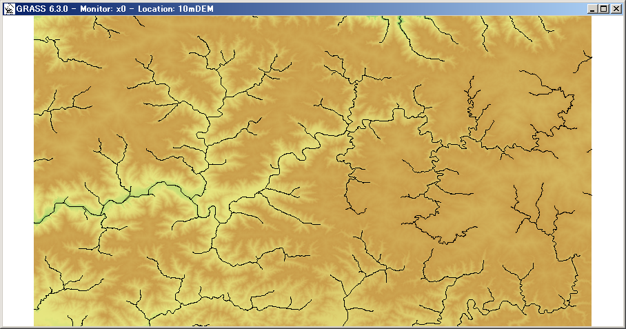
�Ƃ����킯�ŁA�Â��B(20110411)
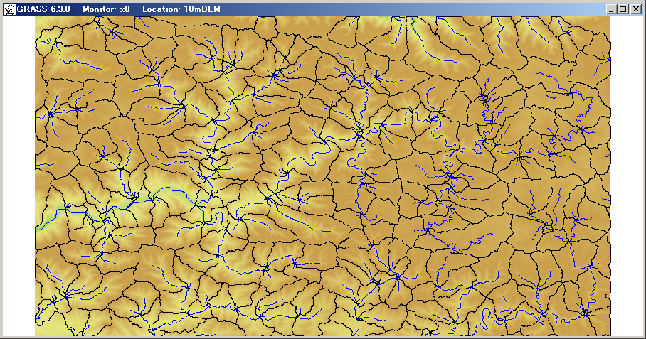
-----
r.watershed elevation=ashu accumulation=ashu_accu basin=ashu_basin threshold=10000
r.to.vect input=ashu_basin output=ashu_basin_vect feature=area
d.vect ashu_basin_vect type=boundary
-----
�R�ǐ�㗬��
�R�ǐ여��S��
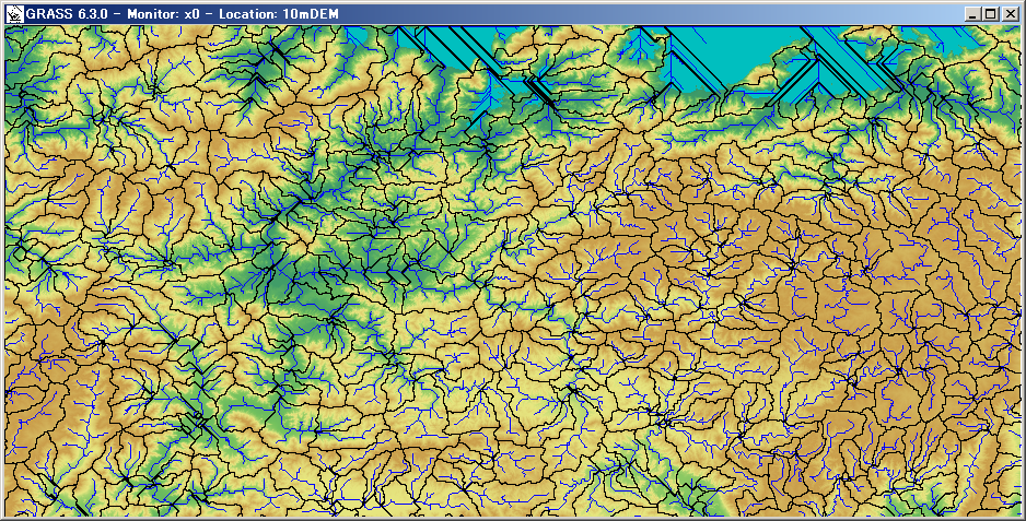
�߂ł����߂ł����B